Farm Mapping
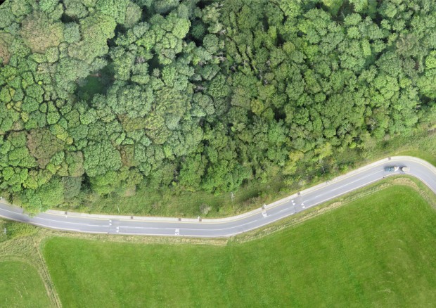
Farming in Ireland is in the midst of a much needed resurgence. Getting absolute efficiency out of your land had never been so important. ASM Irelands Farm Mapping package is of major benefit to progressive farmers looking to achieve these goals. Since most maps currently used by farmers are largely outdated and are of little use having been created in the 1800’s an up to date farm map is a valuable resource. However ASM Ireland maps aren’t just standard line drawings showing just the areas of the different fields, our maps are based on detailed aerial photographs taken with our UAV allowing you to get a bird’s eye view of your entire farm, while maintaining that valuable area information. Supplied in both paper and digital formats measurements can be taken by you at any stage in the future. To see how our service work click here.
ASM Ireland has been featured in Ireland’s leading farming paper the Irish Farmers Journal.
Benefits of an ASM Ireland Farm Map
- Improve Farm Management and Knowledge, between 5 and 17% of Farm areas are non productive, i.e roads, ditches and yards.
- Individual fields are accurately measured allowing more efficient use of sprays and fertilisers. You can determine what you want measured after the survey, this allows ditches, tree lines and scrub areas to be removed if necessary to give an accurate map of actual areas being farmed at any stage in the future, also ensuring you only pay contractors for the area they worked in.
- Feed budgeting accuracy can be improved, even from year to year map areas can be changed effortlessly.
- Improvements in Paddock placement, layout and size can be done at any point in the future.
- High quality aerial photographs allow problem areas requiring attention be effortlessly identified.
- Stocking levels can be confirmed as individual animals are easily counted.
- If you have encountered problems with reductions in SFP areas via remote sensing we can help as our maps are up to 30 times clearer than Department of Agriculture issued maps.
- Land eligibilty issues under the new CAP scheme for Farm payments can be clarfied.
- Invaluable guide for relief workers and farm contractors, work carried out on a per acre basis can also be confirmed.
- Farm expansion plans or layout changes can be developed from and then overlaid directly onto our photomaps.
- We also provide traditional line drawing maps of your farm which can be used for a variety of purposes.
- The entire survey can be done at any time of the year without any damage to your crops.
- Forestry can be measured and monitored with ease, individual Trees can be counted and checked for disease.
Farm Mapping Pack
Our Farm Mapping pack comes as standard with a variety of photographs and drawings on various sizes, typically this includes, 1 nr A4 photographs of the entire farm, a number of close up photographs of individual fields, 2 Nr A4 and 2 Nr A3 standard line drawings all laminated and spreadsheets detailing a variety of information about every field surveyed.
Other options
A variety of other sizes from A1 right down to credit card size for your wallet are also available on request.
A CD with digital copies of everything in the standard map package specially formatted for reprinting at home.
Whiteboards can be designed in a variety of shapes and sizes with your farm map engraved directly onto it allowing notes and instructions to be made to all farm workers.
Improving Farm Layout
Often having viewed the information gathered from an ASM Ireland survey, practical changes to farm layout to increase overall farm efficiency are obvious. If desired we can work with you directly to develop the best possible paddock layout using Teagasc Guidelines for Farm Infrastructure, changing the layout of fields, paddocks and roadways. We can then assist in quickly implementing these changes on the ground using our accurate and time saving GPS setting out systems.
Forestry Mapping
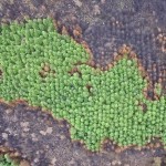
Forestry also benefits from the services provided by ASM Ireland. Often placed in difficult and hostile locations monitoring and measurement is almost impossible. The incredible detail in our photomaps allow you to inspect your entire forest and can have enormous benefits when it comes to planning thinning or clear felling stages, individual trees can easily be counted vastly improving yeild estimations therefore improving management.
Forest Fires & Disease
Forestry that has recently sustained Fire or Storm damage can also be safely assessed without having to enter potentially hazardous zones. Our service produces a map which not only allows damaged trees to be counted but also areas affected to be accurately measured. This ensures plans for reforestation can be developed quickly.
The high resolution of our maps can also allow disease which often starts in the crown of the tree to be detected, potentially saving the entire crop from infection.


